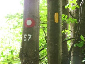
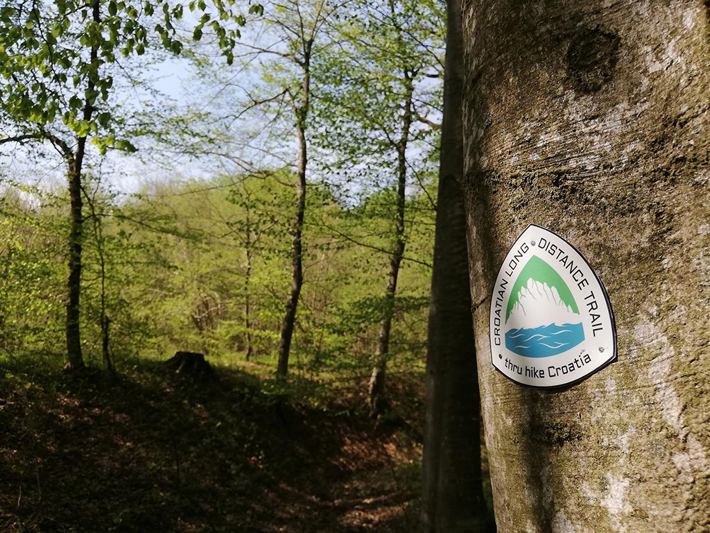
The trail is, in general, very well-marked in most places by standard mountaineering signs. In federally designated wilderness areas (such as national parks) signage and marking is significantly less prominent. Where trail passes through wilderness areas signage is kept to a minimum. Beyond that, there are rare “reassurance markers” (CLDT emblem, see below). You may travel long stretches before seeing a CLDT symbol. That’s generally by design. Unfortunately, some signs might also be stolen or destroyed.
That’s why should always have maps along and be able to navigate through unsigned sections. In an emergency, a map and compass may be your most reliable source of information on how to get off the trail to find help, locate an alternate route, or describe your location and access points to potential rescuers. Cell phones and navigation apps can both can be extremely valuable but are dependent on battery life; cell service is not available in some remote locations on the CLDT.
Official mobile app (main tool for navigating the trail)
While creating the trail we used existing trails, paths and roads. On your CLDT adventure you will walk on all types of terrain, maintained mountain trails, wild trails, hard rock terrains of Dalmatia, forest roads, fields, gravel roads and sometimes on asphalt roads and that’s why CLDT should be walked with assistance of our official mobile application called FarOut.
FarOut offer a variety of hiking guides for long distance trails and regional trail systems. Their guides are used and approved by the majority of triple-crown thru-hikers, so let FarOut guide your next adventure – on the CLDT!
 The map of CLDT is available as an in-app purchase in the FarOut app, a free download from the Apple App Store or the Google Play Store. You can either buy the whole trail package or buy the desired section package. As the trail is still in the making, marking the trail is in the process, meaning that future hikers should rely on mobile app to hike the trail.
Experience problems using the app? Visit FarOut Help Center.
Other means of navigation
Trail markers
In addition to the official mobile app, basic trail marker will be CLDT emblem, 10cm (approx. 3.93in) in radius. It will not have an orienteering purpose but rather it will serve as a basic information stating that you are still on the trail.
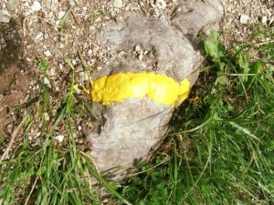
Trail blaze
Unclear and problematic intersections will be marked with our trail blaze (vertical yellow line with a bit of orange pigment 10cm / 3.93in in length). All other markings you’ll see on the trail are not directly related to CLDT – those are regular trail markers used by Croatian mountaineering associations (red-white circles and stripes), Croatian Forestry Service markers & labels, labels for bike and / or horse paths.
HELP US IMPROVE THE TRAIL
We aim to continuously improve the trail. As such, contributions from fellow hikers are essential. You can help us improve the trail by marking spots as waypoints in the official application that need special attention on the trail (path unclear, steep climb, no cell reception) and leaving a short description regarding the problem. If you have any suggestion or comments on how we can improve the trail and your experience on the trail feel free to contact us or if you simply want to financially support Croatian Long Distance Trail Association’s work you can do so by donating here.
